Introduction
Drone-based surveying has shifted from a “luxury add-on” to a fundamental requirement for modern construction and engineering projects. However, simply owning a drone isn’t enough to deliver survey-grade accuracy. To transition a company from traditional methods to a high-precision aerial mapping unit, a specific ecosystem of hardware, software, and human expertise is required.
In this article, we break down exactly what a company needs to adapt for professional surveying and mapping, focusing on DJI’s industry-leading ecosystem and how to integrate ground-based equipment to achieve sub-centimeter deliverables.
1. The Aerial Hardware: Choosing the Right “Eye in the Sky”
For surveying and mapping, accuracy and flight time are the primary constraints. For 2025/2026, the standard for professional entry and enterprise-level operations revolves around DJI’s flagship platforms.
The Portability King: DJI Mavic 3 Enterprise (M3E)
The M3E is the “Swiss Army Knife” of mapping, designed for rapid deployment and high-efficiency surveying.
- Why it works: It features a 4/3 CMOS 20MP sensor with a mechanical shutter (essential for preventing rolling shutter distortion) and supports a dedicated RTK module for centimeter-level accuracy.
- Manpower: 1 Pilot.
- Best for: Small to medium sites, stockpiles, and urban mapping.
The Flagship Powerhouse: DJI Matrice 350 RTK
The Matrice 350 RTK remains the industry-leading platform for high-precision, multi-sensor missions.
- Why it works: It offers an IP55 rating, enhanced O3 Enterprise transmission, and a payload capacity that supports the most advanced sensors in the industry. With up to 55 minutes of flight time and hot-swappable batteries, it is built for continuous operation.
The Next Generation: DJI Matrice 400 RTK
The recently introduced Matrice 400 RTK sets a new benchmark for endurance and safety, designed for the most demanding enterprise environments.
- Why it works: Enhanced IP56 weather resistance, O4 Enterprise transmission for superior link stability, and dual-battery systems for increased redundancy.
- Manpower: 1 Pilot + 1 Spotter (optional).
2. Precision Payloads: The True Surveyors
A drone is only as good as the sensor it carries. For mapping, two sensors currently dominate the DJI ecosystem:
- Zenmuse P1 ( Photogrammetry ) : The gold standard for photogrammetry. It integrates a 45MP full-frame sensor with interchangeable fixed-focus lenses on a 3-axis stabilized gimbal.
- Zenmuse L3( LiDAR ) : The latest evolution in LiDAR. It combines high-accuracy LiDAR, a self-developed high-accuracy IMU system, and a 4/3 CMOS RGB mapping camera, providing more precise geospatial data.
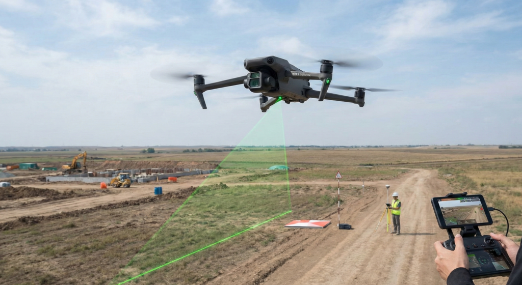
3. Improving Quality with Ground Surveying Equipment
A drone is an aerial sensor, but its data is only as good as its reference to the real world. To achieve “survey-grade” (1–3 cm accuracy), you must use ground-based reference points.
RTK (Real-Time Kinematic) vs. PPK (Post-Processed Kinematic)
While DJI drones have built-in RTK, signal drops in remote areas or urban canyons can occur.
- Solution: Use a High-Precision GNSS Mobile Station to provide a constant correction stream.
D-RTK 2 vs. D-RTK 3: Choosing Your Base Station
DJI offers two primary base stations, and choosing the right one depends on your drone platform:
- D-RTK 2: The veteran high-precision GNSS receiver that supports multiple satellite systems. It is the go-to for the Matrice 350 RTK and Mavic 3 Enterprise series. It provides centimeter-level positioning data by acting as a powerful RTK base station.
- D-RTK 3: Optimized for the high-bandwidth requirements of the latest flagship systems like the Matrice 400 RTK. It offers superior anti-interference capabilities and enhanced stability for high-precision, long-range mapping.
- The Verdict: If you are running a standard Mavic 3E fleet, the D-RTK 2 is your reliable partner. For those scaling into the flagship Matrice 400 RTK or high-interference environments, the D-RTK 3 is the superior, future-proof choice.
Ground Control Points (GCPs)
Even with an RTK drone, placing 3–5 GCPs using a traditional GNSS rover ensures the model is perfectly aligned with the local coordinate system and serves as an independent check for vertical accuracy.
- Pro Tip: Use black-and-white checkerboard targets (physical hardware) visible from the air.
3. The Software Ecosystem: Turning Images into Intelligence
Raw photos are useless without a photogrammetry engine. A mapping company needs a tiered software approach.
Processing Software
- DJI Terra: The fastest processing software for DJI drones. It handles 2D orthomosaics and 3D models with native support for DJI sensors.
- Pix4Dmatic / Pix4Dmapper: The industry standard for complex topography and vegetation-heavy areas.
- Bentley ContextCapture: For large-scale 3D city modeling and infrastructure projects.
GIS and CAD Analysis
Once the model is processed, it must be used in a design environment:
- AutoCAD / Civil 3D: For creating contour lines, cross-sections, and volume calculations.
- ArcGIS / QGIS: For geospatial analysis and database management.
4. Manpower: The Human Element
A drone surveying unit is not just a pilot’s job. It requires a blend of aviation and engineering skillsets.
- The Drone Pilot: Must be certified and experienced in automated flight planning.
- The Surveyor/GIS Specialist: The “brain” of the operation. They ensure the data adheres to engineering standards and local Dubai/UAE coordinate systems (like DLTM).
- Data Analyst: Responsible for processing the massive point clouds and generating the final reports.
| Category | Type | Suggested |
|---|---|---|
| Hardware | Mapping Drone | DJI Mavic 3 Enterprise or Matrice 400 RTK |
| Mapping Payload | High-Res Sensor | Zenmuse P1 (Visual) or Zenmuse L2 (LiDAR) |
| Ground Hardware | GNSS Base Station | DJI D-RTK 3 (High-Bandwidth) or D-RTK 2 |
| Software | Photogrammetry | DJI Terra (Native Integration) |
| Analysis | CAD/GIS Software | Autodesk Civil 3D / ArcGIS |
| Manpower | Certified Staff | GVC Certified Pilot + GIS Specialist |
Conclusion: The ZID Advantage
Adapting a company for drone surveying is about more than buying a drone; it’s about building a workflow that produces reliable, legally defensible data. By combining DJI’s aerial platforms with high-end ground surveying hardware and robust processing software, companies can reduce site time by 70% while improving safety.
Contact us today to learn how ZID can help you select, procure, and train your team for high-precision drone surveying.
Internal Links: